Lithosphere – KPSC Mains Notes
1. Introduction
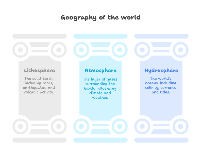
- The Lithosphere is the solid outer part of the Earth, consisting of the crust and uppermost mantle.
- Understanding its components—like rocks, tectonic movements, and erosion—is vital to comprehend Earth’s dynamic nature, natural disasters, and resource distribution.
2. Place of Earth in the Solar System
- Earth is the third planet from the Sun in the solar system.
- It lies in the habitable zone, making life possible due to moderate temperature, presence of water, and protective atmosphere.
- Geological implications:
- Gravitational forces from the Moon and Sun influence tides and plate motions.
- Solar radiation affects weathering and erosion.
3. Rocks: Types and Characteristics
- Rocks form the fundamental component of the lithosphere.
Types of Rocks:
- Igneous Rocks – formed by solidification of magma (e.g., Basalt – Deccan Traps).
- Sedimentary Rocks – formed by deposition of sediments (e.g., Sandstone in Kaladgi Basin, Karnataka).
- Metamorphic Rocks – formed under high pressure and temperature (e.g., Gneiss – Peninsular India).
Karnataka Specific Example:
- The Dharwar Craton in Karnataka is one of the oldest geological formations in India, rich in minerals like gold and iron.
4. Earthquakes
- Sudden release of energy due to tectonic stress resulting in seismic waves.
- Measured by Richter Scale and Mercalli Intensity Scale.
Causes:
- Plate tectonics, volcanic activity, human activities (e.g., mining, dams).
Zones in India:
- India divided into seismic zones II to V; Zone V is the most severe.
- Karnataka lies mostly in Zone II and III (moderate risk), but intra-plate quakes are possible.
Notable Case:
- Latur Earthquake (1993) – intra-plate quake that changed perception of earthquake risk in the peninsular region.
5. Volcanoes
- Openings on Earth’s surface that eject molten lava, ash, and gases.
Types:
- Active – e.g., Barren Island (Andaman).
- Dormant
- Extinct – e.g., Deccan Volcanic Province (now basaltic plateau).
Impact:
- Fertile soil, mineral deposits (beneficial).
- Disasters and climate impact (hazards).
6. Plate Tectonics
- Earth’s lithosphere is broken into plates that float over the semi-fluid asthenosphere.
Plate Movements:
- Divergent – plates move apart (Mid-Atlantic Ridge).
- Convergent – plates collide (Himalayan formation).
- Transform – plates slide past (San Andreas Fault).
Indian Context:
- Indian Plate moving northwards, colliding with Eurasian Plate → Himalayas formation and frequent earthquakes.
7. Agents of Erosion
- Natural forces that wear away Earth’s surface:
Types:
- Water – rivers (Cauvery and Tungabhadra erosion plains in Karnataka).
- Wind – arid regions like Thar desert.
- Glaciers – limited to Himalayas.
- Waves and Currents – shaping coastlines (Karwar and Udupi coasts in Karnataka).
- Human Activities – deforestation, mining.
8. Challenges and Issues
- Unplanned urbanization increases vulnerability to earthquakes.
- Mining and quarrying in Karnataka (e.g., Ballari) cause land degradation and trigger minor tremors.
- Lack of awareness and disaster preparedness in vulnerable areas.
9. Government Schemes & Interventions
- National Seismic Zoning Map – for safe construction planning.
- National Disaster Management Authority (NDMA) – guidelines on earthquakes and landslides.
- Soil and Water Conservation Programs – e.g., Watershed Development Projects in Karnataka for erosion control.
10. Committees & Reports
- Kasturirangan Committee – conservation of Western Ghats, reducing human impact on fragile ecosystems.
- National Building Code – recommendations on quake-resistant construction.
- National Mineral Policy 2019 – sustainable mining practices.
11. Current Affairs & Relevance
- Rising climate-linked disasters like glacial outbursts and flash floods.
- Recent reports of minor tremors in Bangalore and Mandya districts, attributed to seismic reactivation.
- Ongoing erosion issues in coastal Karnataka due to sea level rise.
12. Examples & Case Studies
- Coastal erosion in Udupi – resulted in property loss, mitigated through geo-synthetic seawalls.
- Ballari mining impact – led to Supreme Court intervention for environmental regulation.
- Earthquake-resilient construction in North-East – model for expanding to Zone III areas in Karnataka.
13. Conclusion & Way Forward
- A sound understanding of lithospheric processes is vital for disaster risk reduction and sustainable development.
- Need for:
- Community-level awareness.
- Improved geological mapping.
- Enforcing zoning regulations and construction codes.
- Integration of remote sensing and GIS tools for monitoring changes in landforms.
Atmosphere – KPSC Mains Notes
1. Introduction
- The atmosphere is a thin layer of gases surrounding the Earth, essential for sustaining life.
- It regulates temperature, protects from harmful radiation, and facilitates the hydrological cycle.
- Understanding the atmosphere is crucial for studying weather, climate, and natural disasters.
2. Structure of the Atmosphere
The atmosphere is divided into five layers based on temperature variation:
| Layer | Altitude | Characteristics |
|---|---|---|
| Troposphere | 0–12 km | Weather phenomena occur here; temperature decreases with altitude. |
| Stratosphere | 12–50 km | Contains the ozone layer; temperature increases with altitude. |
| Mesosphere | 50–80 km | Coldest layer; meteors burn here. |
| Thermosphere | 80–700 km | Contains ionosphere; auroras occur here. |
| Exosphere | >700 km | Outermost layer; merges into space. |
3. Composition of the Atmosphere
| Gas | Percentage |
|---|---|
| Nitrogen (N₂) | 78% |
| Oxygen (O₂) | 21% |
| Argon (Ar) | 0.93% |
| Carbon dioxide (CO₂) | 0.04% |
| Others (Ne, He, CH₄, etc.) | Trace amounts |
- Water vapor: Varies from 0–4%; essential for weather phenomena.
- Dust particles, pollen, smoke: Act as nuclei for condensation.
4. Elements of Climate and Weather
Difference:
- Weather: Short-term atmospheric conditions (e.g., rain, wind).
- Climate: Long-term average weather patterns (30+ years).
Key Elements:
- Temperature: Affects agriculture and biodiversity.
- Karnataka: Coastal regions (Karwar, Mangaluru) have equable climate; interior (Ballari) shows high diurnal variation.
- Pressure: Drives wind and monsoon systems.
- Wind: Includes trade winds, westerlies; local winds like Monsoons dominate in India.
- Humidity: High in coastal Karnataka, low in northern dry zones.
- Precipitation: Includes rainfall, snow, hail.
- Example: Agumbe (Western Ghats) – one of the highest rainfall regions in India.
- Cloud Cover: Influences temperature and solar radiation.
5. Broad Climatic Types
Based on Köppen’s Climate Classification:
| Type | Characteristics | Indian Example |
|---|---|---|
| Tropical Wet (Af) | High rainfall, no dry season | Western Ghats (Agumbe, Sringeri) |
| Tropical Wet & Dry (Aw) | Distinct wet/dry seasons | Most of Karnataka (Bengaluru, Mysuru) |
| Semi-Arid (BS) | Low rainfall, high evapotranspiration | Northern Karnataka (Ballari, Raichur) |
| Montane (H) | High altitude, variable climate | Himalayas (not in Karnataka) |
Karnataka’s Climatic Zones:
- Coastal Zone: High humidity, heavy rainfall.
- Malnad (Western Ghats): Tropical wet; dense forests, heavy monsoon rains.
- Southern Maidan: Tropical savanna; moderate rainfall.
- Northern Dry Zone: Semi-arid; prone to droughts.
6. Challenges and Issues
- Climate Variability: Erratic monsoons affecting agriculture.
- Urban Heat Islands: Increasing in Bengaluru due to concrete sprawl.
- Frequent Droughts in northern Karnataka due to semi-arid climate.
- Floods during monsoon in coastal and Malnad areas.
7. Government Schemes & Interventions
- National Action Plan on Climate Change (NAPCC) – includes missions on solar energy, water, and sustainable agriculture.
- Karnataka State Action Plan on Climate Change (SAPCC) – region-specific climate adaptation strategies.
- Desert Development Programme – implemented in dry districts like Koppal and Gadag.
8. Committees & Reports
- M.S. Swaminathan Committee – emphasized climate-resilient agriculture.
- Kasturirangan Committee – recommended environmental conservation in Western Ghats to mitigate climate-related disasters.
- IPCC Reports – highlight global climate change impacts, including Indian monsoon variability.
9. Current Affairs & Relevance
- 2023 Monsoon Trends – below-average rainfall in north Karnataka, flood in Udupi.
- Bengaluru Urban Flooding (2022) – intense rainfall + poor drainage.
- Heatwaves – increasing frequency in Ballari and Kalaburagi.
10. Examples & Case Studies
- Agumbe (Shimoga District) – called “Cherrapunji of South India” due to high rainfall (9000+ mm).
- Drought in Koppal – crop failure in 2023, leading to increased migration.
- Floods in Kodagu (2018) – triggered landslides and displaced communities.
11. Conclusion & Way Forward
- Understanding atmospheric processes is vital for agriculture, disaster management, and climate resilience.
- Karnataka must:
- Promote climate-resilient crops.
- Improve weather forecasting systems (IMD + local models).
- Implement green infrastructure in urban areas.
- Integrate traditional knowledge with modern climate planning.
Hydrosphere – KPSC Mains Notes
1. Introduction
- The Hydrosphere encompasses all water bodies on Earth – oceans, seas, rivers, lakes, underground water, and glaciers.
- Covers about 71% of Earth’s surface, with oceans accounting for 97% of total water.
- Crucial for climate regulation, biodiversity, trade, and human livelihood.
2. World Oceans
There are five major oceans, all interconnected:
- Pacific Ocean – largest and deepest.
- Atlantic Ocean – second largest, busiest in terms of trade routes.
- Indian Ocean – third largest, warmest; India has a long coastline of 7517 km, including Karwar to Mangaluru in Karnataka.
- Southern Ocean – encircles Antarctica.
- Arctic Ocean – smallest and shallowest.
Karnataka Context:
- Karnataka has a 320 km coastline along the Arabian Sea with ports like Mangaluru and Karwar, playing a key role in fisheries and trade.
3. Salinity of Oceans
- Salinity refers to the concentration of dissolved salts in seawater, usually expressed in parts per thousand (‰).
- Average salinity: ~35‰ (35 grams of salt per 1 kg of seawater).
Factors Affecting Salinity:
- Evaporation (increases salinity).
- Precipitation & River inflow (decrease salinity).
- Ocean currents and melting of icebergs.
Global Variations:
- High in subtropical regions (20°–30° latitude).
- Low near the equator and polar regions.
Karnataka Coast:
- Moderate salinity due to monsoon rainfall and river inflow (e.g., Netravati and Sharavathi rivers).
4. Ocean Currents
- Large-scale movements of surface water caused by wind, Coriolis force, temperature, and salinity gradients.
Types:
- Warm Currents – Flow from equator to poles (e.g., Gulf Stream, Kuroshio).
- Cold Currents – Flow from poles to equator (e.g., Humboldt, Canary).
Importance:
- Affect marine life, climate, navigation, and fishing.
- Create fog and desert conditions (e.g., Atacama Desert).
Indian Ocean Currents:
- Dominated by Monsoon Currents:
- South-West Monsoon Current (Summer) – flows from west to east.
- North-East Monsoon Current (Winter) – flows from east to west.
Karnataka Context:
- Influences fishing activities and port operations.
- Warm currents support marine biodiversity along Karnataka’s coast.
5. Tides
- Periodic rise and fall of sea levels due to gravitational pull of the Moon and Sun.
Types of Tides:
- Spring Tide – High tide during new and full moon.
- Neap Tide – Low tide during quarter moons.
- Diurnal, Semi-diurnal, and Mixed Tides – Based on frequency.
Importance:
- Navigation, fishing, tidal energy, and port planning.
Tidal Energy:
- Emerging as renewable source in India.
- Karnataka’s coast has potential, though development is in early stages.
6. Ocean Deposits
- Accumulated sediments at the ocean floor, classified by origin.
Types:
- Terrigenous Deposits – From land (sand, silt, clay).
- Biogenous Deposits – From marine organisms (shells, corals).
- Hydrogenous Deposits – Chemical precipitation (manganese nodules).
- Volcanic Deposits – From underwater volcanic activity.
Economic Importance:
- Source of oil, gas, and polymetallic nodules.
- India has rights over 75,000 sq km in Central Indian Ocean Basin under UNCLOS.
Karnataka Relevance:
- Potential for marine mineral exploration.
- Sediment deposition near estuaries like Netravati supports rich mangrove ecosystems.
7. Challenges and Issues
- Marine Pollution: From plastics, oil spills, and untreated sewage (e.g., Bengaluru’s Bellandur Lake outflows impact downstream rivers).
- Coastal Erosion: Seen along Udupi and Uttara Kannada coastlines.
- Overfishing: Affects livelihoods in coastal Karnataka.
- Climate Change: Causes sea-level rise, acidification, and coral bleaching.
8. Government Schemes & Interventions
- Sagarmala Project – Port-led development, includes Karwar and Mangaluru ports.
- Deep Ocean Mission – Under Ministry of Earth Sciences for underwater exploration.
- ICZM Project (Integrated Coastal Zone Management) – Implemented in coastal Karnataka for erosion control and ecosystem protection.
- Blue Economy Policy – Sustainable use of ocean resources.
9. Committees & Reports
- Swaminathan Committee – Suggested sustainable coastal development.
- NITI Aayog’s Blue Economy Framework – Advocates harnessing marine resources responsibly.
- CRZ Notification (2019) – Regulates construction and development in coastal areas.
10. Current Affairs & Relevance
- 2023: Coastal erosion near Kundapura due to monsoon tides.
- Karwar Port Expansion – Environmental impact under review.
- Plastic bans in coastal districts to protect marine life.
11. Examples & Case Studies
- Mangaluru Fishing Harbour – Major fish export hub in Karnataka.
- Sea erosion control using geotextiles in Udupi (pilot project success).
- Estuarine biodiversity in Sharavathi backwaters, vital for climate resilience.
12. Conclusion & Way Forward
- The hydrosphere plays a vital role in climate regulation, economic development, and biodiversity.
- Karnataka’s coastline offers significant opportunities in blue economy, tourism, and conservation.
- Focus areas:
- Strengthen coastal monitoring and disaster preparedness.
- Promote marine spatial planning.
- Expand research in deep-sea minerals and renewable tidal energy.