Posted in

P2 S1 U4: Industrial Planning and Development – KPSC/KAS Notes

Growth and Distribution of Major, Medium, Small and Tiny Industries – Industrial Regions of India


I. Introduction

  • Industrial development plays a crucial role in India’s economic growth, employment generation, urbanization, and export potential.
  • The Indian industrial sector is categorized into major (large-scale), medium, small, and tiny (micro) enterprises, each contributing uniquely to the economy.
  • The sector is influenced by availability of raw materials, capital, infrastructure, skilled labor, and proximity to markets.

II. Key Concepts & Classifications

1. Major Industries (Large-Scale)

  • Characterized by heavy investments (more than ₹50 crore), high employment, large infrastructure.
  • Examples: Iron & steel, petrochemicals, cement, automobile, etc.

2. Medium Enterprises

  • Investment: ₹10 crore – ₹50 crore (as per MSME Development Act, 2006 revised in 2020).
  • Often act as a bridge between large and small enterprises.
  • Sectors: Textiles, pharmaceuticals, food processing, etc.

3. Small Scale Industries (SSIs)

  • Investment less than ₹10 crore (manufacturing) or ₹5 crore (services).
  • Labor-intensive and decentralized in nature.
  • Products: Handlooms, handicrafts, toys, leather, etc.

4. Tiny / Micro Enterprises

  • Investment: Up to ₹1 crore (manufacturing) or ₹50 lakh (services).
  • Often family-owned or cottage industries.
  • Examples: Pottery, rural artisan products, agarbatti making, etc.

III. Growth of Indian Industries

🔹 Pre-Independence Era

  • Growth centered around port towns: Mumbai, Kolkata, Chennai.
  • Major sectors: Textiles, jute, and plantation-based.

🔹 Post-Independence (1947–1991)

  • Focus on import substitution, PSUs, and heavy industries (e.g., BHEL, SAIL).
  • Five-Year Plans prioritized regional development and backward area growth.

🔹 Post-Liberalization (1991 onwards)

  • Growth of IT, automobile, pharma, and service-based industries.
  • FDI inflows and industrial corridors gained importance.

🔹 Recent Trends

  • Rise of Start-ups, MSMEs, Make in India, PLI Schemes.
  • Green manufacturing and automation (Industry 4.0).

IV. Industrial Regions of India

India’s industrial development is geographically concentrated in several major industrial regions:

1. Mumbai–Pune Industrial Region

  • Industries: Automobiles (Tata, Mahindra), IT, petrochemicals, textiles.
  • Key Hubs: Mumbai, Pune, Nashik.

2. Ahmedabad–Vadodara Region

  • Known for cotton textiles, chemicals, and engineering.
  • GIDC promoted cluster-based development.

3. Delhi–Meerut–Gurgaon–Faridabad Belt

  • Industries: IT, electronics, garments, engineering goods.
  • NCR Planning Board promotes integrated development.

4. Chennai–Coimbatore–Bengaluru Triangle

  • Sectors: Automobiles, IT, aerospace, electronics.
  • Hubs: Chennai (Detroit of India), Hosur, Bengaluru (Silicon Valley of India).

5. Kolkata–Asansol–Durgapur Region

  • Legacy region with jute, iron & steel, and heavy engineering.

6. Chotanagpur Plateau Region (Jamshedpur–Bokaro)

  • Rich in minerals like iron ore and coal.
  • Industries: Steel (TISCO, Bokaro Steel Plant), power, chemicals.

7. Hyderabad–Secunderabad Region

  • Sectors: IT, defense, pharmaceuticals (Genome Valley).

V. Karnataka-Specific Industrial Development

🔹 Major Industrial Clusters

  • Bengaluru: IT, aerospace, biotech, and electronics.
  • Mysuru: Silk, sandalwood, IT.
  • Ballari: Iron and steel (JSW Steel).
  • Mangaluru: Petrochemicals, refineries, port-based industries.
  • Shivamogga: Agro-processing and engineering.

🔹 Notable Initiatives

  • Karnataka Udyog Mitra: Single-window clearance for industries.
  • Clusters: Peenya Industrial Area (Bengaluru), Asia’s largest small-scale industrial cluster.

VI. Challenges & Issues

  • Infrastructure Deficiency: Poor roads, power supply in rural areas.
  • Land Acquisition: Delays and resistance in industrial corridors.
  • Skill Mismatch: Need for industry-ready workforce.
  • MSME Constraints: Credit access, market linkages, technology.
  • Pollution & Sustainability: Industrial waste and ecological degradation.

VII. Government Schemes & Interventions

🏛️ Central Government Initiatives

  • Make in India: Promote manufacturing.
  • Production Linked Incentive (PLI): Boost electronics, pharma, textiles.
  • Startup India & Stand-Up India: Support for innovation and entrepreneurship.
  • MSME SAMADHAAN & CHAMPIONS Portal: Grievance redressal and growth support.

🏛️ Karnataka State Schemes

  • New Industrial Policy (2020–25): Focus on Tier-2/3 cities and innovation.
  • Elevate 100: Start-up support.
  • Karnataka Export Promotion Policy: Facilitate global market access.

VIII. Committees & Reports

  • Abid Hussain Committee (1997): Emphasized reforms in small-scale industries.
  • Raghuram Rajan Committee (2013): Highlighted regional disparities and backward area development.
  • NITI Aayog Reports: Promoted cluster-based development and digital MSMEs.
  • Economic Survey: MSME sector employs over 11 crore people; ~30% of GDP share.

IX. Current Affairs & Relevance

  • PLI Scheme 2.0 (2023): Incentives extended to MSMEs and electronics sectors.
  • Industrial Corridor Projects: Bengaluru–Mumbai and Chennai–Bengaluru corridors.
  • Futuristic Trends: AI in manufacturing, Green Industries, Circular Economy.
  • Karnataka Global Investors Meet (2022): Investment proposals worth ₹10+ lakh crore.

X. Examples & Case Studies

  • JSW Steel, Ballari: One of India’s largest integrated steel plants.
  • Peenya Industrial Area: Contributes significantly to Karnataka’s GDP and exports.
  • Biotech Cluster, Bengaluru: Leading in vaccine and biotech R&D (e.g., Biocon).
  • Textile Parks in Davanagere & Vijayapura: Part of PM-MITRA Scheme.

XI. Conclusion & Way Forward

  • A balanced approach is needed to ensure equitable industrial development across regions.
  • MSMEs should be empowered through easier credit, skilling, and digital infrastructure.
  • Investment in Green and Smart Manufacturing can future-proof Indian industry.
  • Karnataka should leverage its human capital and innovation hubs to expand beyond Bengaluru-centric growth.

Industrial Infrastructure – Railways, Roads, and Ports


I. Introduction

  • Industrial infrastructure refers to the physical facilities that support industrial activities, including transportation, logistics, and utilities.
  • Railways, roads, and ports are the backbone of industrial growth, enabling raw material inflow and finished goods outflow.
  • India’s rapid industrialization and export-oriented growth necessitate robust infrastructure.

II. Key Concepts & Importance

Role of Industrial Infrastructure

  • Logistics efficiency: Reduces cost and time of goods movement.
  • Regional development: Industrial corridors stimulate backward areas.
  • Employment generation: Infrastructure development creates direct and indirect jobs.
  • Global competitiveness: Efficient transport boosts export performance.

III. Railways

🔹 Overview

  • 4th largest railway network in the world (~68,000 km).
  • Lifeline for movement of bulk commodities: coal, steel, cement, fertilizers.

🔹 Role in Industrial Infrastructure

  • Freight Corridors: Crucial for bulk transportation.
  • Industrial Connectivity: Links production centers to ports and markets.
  • Dedicated Freight Corridors (DFCs):
    • Eastern DFC: Coal and steel belt.
    • Western DFC: Ports to hinterland.

🔹 Karnataka Specifics

  • Hubballi Division: Major freight movement zone in South Western Railway.
  • Railway Zone HQ: South Western Railway (SWR) headquartered in Hubballi.
  • Goods Terminals: Whitefield (Bengaluru), Panambur (Mangaluru), Hosapete.
  • Suburban Rail Project, Bengaluru: Decongestion and connectivity to industrial suburbs.

IV. Roads

🔹 Overview

  • India has the second-largest road network in the world (~6.3 million km).
  • Roads carry over 60% of freight and 85% of passenger traffic.

🔹 Types of Roads

  • National Highways (NHs): Long-distance industrial and freight movement.
  • State Highways (SHs): Connect industrial towns to NHs.
  • Rural Roads (PMGSY): Enable rural agro-industrial integration.

🔹 Role in Industry

  • First and last-mile connectivity to industrial estates and logistics parks.
  • Expressways and Economic Corridors: Support cluster-based industrial growth.
  • Industrial Corridor Roads: Seamless transport from production to export zones.

🔹 Karnataka Specifics

  • Bengaluru–Mysuru Expressway: Boosts industrial growth in Mandya, Mysuru.
  • NH-75, NH-44: Connects Bengaluru to ports (Mangaluru, Chennai).
  • Kalyana Karnataka Connectivity: Ballari, Kalaburagi connected to cement and steel industries.
  • State Industrial Corridors: Bengaluru–Mumbai Industrial Corridor (BMIC), Chennai–Bengaluru–Chitradurga corridor.

V. Ports

🔹 Overview

  • India has 13 major ports and ~200 minor/intermediate ports.
  • 95% of India’s trade by volume and 70% by value is handled through ports.

🔹 Classification

  • Major Ports: Managed by central government (e.g., Mormugao, Chennai).
  • Non-Major (Minor) Ports: Managed by state governments.

🔹 Importance for Industry

  • Import/export hubs for raw materials (e.g., crude, coal) and finished goods (e.g., textiles, auto).
  • Port-Based Industrial Development: Clusters like SEZs and petrochemical hubs near ports.
  • Sagarmala Project: Coastal economic zones and multimodal connectivity.

🔹 Karnataka Specifics

  • New Mangalore Port:
    • Handles petroleum products, fertilizers, iron ore, and container cargo.
    • Linked to hinterland industries of Ballari, Shivamogga, and Hassan.
  • Karwar Port: Under development; planned for coastal cargo and naval use.
  • Belekeri & Tadadi Ports: Minor ports handling iron ore exports.

VI. Challenges & Issues

SectorKey Issues
RailwaysCapacity constraints, outdated infrastructure, high freight costs.
RoadsCongestion, poor rural road quality, slow highway development.
PortsInefficient cargo handling, underdeveloped hinterland linkages, bureaucratic delays.
  • Environmental Concerns: Land acquisition and ecological impact.
  • Multimodal Disconnect: Lack of integration between road–rail–port systems.
  • Funding & PPP Bottlenecks: Infrastructure projects often face delays.

VII. Government Schemes & Interventions

🏛️ Central Schemes

  • Gati Shakti – National Master Plan: Unified logistics infrastructure platform.
  • Sagarmala Project: Port modernization, connectivity, and port-linked industrialization.
  • Bharatmala Project: National highways and economic corridors development.
  • PM Gati Shakti Multimodal Cargo Terminals: Integrate rail-road-port logistics.

🏛️ Karnataka Initiatives

  • Karnataka State Logistics Policy (2023): Emphasis on multimodal parks and last-mile connectivity.
  • Integrated Logistics Parks: Locations like Dobbaspet, Tumakuru, Hubballi.
  • Elevated Corridors in Bengaluru: Ease movement to Peenya and industrial outskirts.

VIII. Committees & Reports

  • Rakesh Mohan Committee (2002): Emphasized urgent investment in transport infrastructure.
  • National Transport Development Policy Committee (NTDPC): Advocated integrated planning across road, rail, port, and air sectors.
  • Economic Survey (Recent): Highlights reduction in logistics cost from 14% to ~8% targeted through Gati Shakti and Sagarmala.
  • NITI Aayog: Promotes public-private partnerships and digital infrastructure integration (e.g., FASTag, Freight apps).

IX. Current Affairs & Relevance

  • PM Gati Shakti Platform Launched (2021): A digital infrastructure map integrating 16 ministries.
  • Dedicated Freight Corridors (DFC) becoming operational in phases.
  • Vadhavan Port (Maharashtra) and Paradip Expansion for eastern trade.
  • Logistics Performance Index 2023: India ranked 38th, improved infrastructure noted.
  • Karnataka Industrial Policy 2020–25: Focus on logistics hubs and connectivity to rural industrial clusters.

X. Examples & Case Studies

  • Peenya Industrial Cluster, Bengaluru: Benefitted from road connectivity and suburban rail projects.
  • Ballari Steel Industry: Efficiently connected via South Western Railway and NH-67.
  • Mangaluru Refinery (MRPL): Port-led development with pipeline and rail terminal integration.
  • Tumakuru Industrial Node (under CBIC): Linked by highways and rail for electronics & textile exports.

XI. Conclusion & Way Forward

  • Industrial infrastructure must be multi-modal, digitalized, and sustainable.
  • Prioritize investment in rural–urban–port connectivity to unlock regional industrial potential.
  • Karnataka must capitalize on its location advantage by integrating road, rail, and port networks under schemes like Gati Shakti.
  • Strengthening logistics, infrastructure, and industrial ecosystem will make India globally competitive and resilient.

Backward Regions and Rural Industrialisation


I. Introduction

  • Backward regions refer to areas lagging in socio-economic development due to inadequate infrastructure, low literacy, poor industrial base, and high poverty.
  • Rural industrialisation aims to promote industries in rural and underdeveloped areas to generate employment, curb migration, and ensure balanced regional growth.
  • It aligns with inclusive development goals and the vision of Atmanirbhar Bharat.

II. Key Concepts & Features

Backward Regions

  • Characterized by:
    • Low per capita income
    • High unemployment and underemployment
    • Inadequate infrastructure (roads, electricity, communication)
    • Poor industrial penetration and capital investment
  • Identified through indices like Backwardness Index, Human Development Index (HDI), and Regional Disparity Measures.

Rural Industrialisation

  • Promotes setting up of small, cottage, agro-based and non-farm enterprises in rural areas.
  • Aims to:
    • Generate local employment
    • Utilize local resources
    • Reduce urban migration
    • Create self-sustained rural economies

III. Importance of Rural Industrialisation in Backward Regions

  • Employment Generation: Labour-intensive industries absorb surplus rural workforce.
  • Decentralised Development: Reduces regional imbalance and stress on urban centers.
  • Utilisation of Local Resources: Promotes resource efficiency and local entrepreneurship.
  • Women Empowerment: Many rural industries are women-led (e.g., handloom, food processing).
  • Boosts Agro-based Economy: Value addition to agricultural produce.

IV. Major Rural Industries in India

Industry TypeExamples
Agro-basedFood processing, sugar, jute, dairy, oil extraction
Forest-basedLac, honey, bamboo crafts, herbal products
Handicrafts & HandloomsTextiles, terracotta, wood carving
Rural ServicesRepair shops, packaging, cold storage
Mineral-based (in tribal areas)Stone carving, pottery, brick kilns

V. Challenges in Backward Region Industrialisation

  • Infrastructure Deficit: Power, roads, and water constraints.
  • Credit & Finance Barriers: Limited access to institutional credit and high collateral demands.
  • Lack of Skilled Labour: Inadequate vocational training and education.
  • Market Linkage Issues: Poor access to urban or export markets.
  • Policy Implementation Gaps: Bureaucratic delays, lack of convergence.
  • Migration: Rural youth prefer cities due to better opportunities.

VI. Government Schemes & Interventions

🏛️ Central Government Initiatives

  • Backward Regions Grant Fund (BRGF) (now subsumed under Rashtriya Gram Swaraj Abhiyan):
    • Aimed at filling infrastructure gaps in 250 backward districts.
  • Micro and Small Enterprises – Cluster Development Programme (MSE-CDP):
    • Supports creation of Common Facility Centres (CFCs) in rural clusters.
  • SFURTI (Scheme of Fund for Regeneration of Traditional Industries):
    • Revives khadi, coir, and village industries.
  • PMEGP (Prime Minister’s Employment Generation Programme):
    • Credit-linked subsidy for rural entrepreneurs.
  • RURBAN Mission:
    • Converts rural clusters into growth centers by providing urban-like facilities.
  • One District One Product (ODOP):
    • Promotes local specialty products (e.g., Channapatna toys, Mysuru silk).

🏛️ Karnataka-Specific Initiatives

  • Karnataka Industrial Policy (2020–25):
    • Offers incentives for setting up industries in Kalyana Karnataka and Malnad regions.
  • Karnataka Udyog Mitra:
    • Single-window clearance for rural entrepreneurs.
  • Development of Industrial Estates in Tier-3 cities: Targeting backward taluks.
  • Karnataka Rural Infrastructure Development Limited (KRIDL):
    • Supports rural industrial infrastructure.

VII. Committees & Reports

  • Raghuram Rajan Committee (2013):
    • Classified backward states and districts; recommended special aid.
  • Abid Hussain Committee on Small Enterprises (1997):
    • Emphasized rural entrepreneurship and cluster development.
  • Planning Commission Reports:
    • Advocated rural non-farm sector expansion for inclusive growth.
  • NITI Aayog Reports:
    • Recommend convergence of infrastructure, skill, and credit support.

VIII. Current Affairs & Relevance

  • Budget 2024–25:
    • Focus on rural start-ups, handloom clusters, and rural logistics infrastructure.
  • Vocal for Local & Atmanirbhar Bharat:
    • Boosts local rural products, crafts, and processing industries.
  • Digital Empowerment:
    • E-commerce platforms like GeM and ONDC open up new markets for rural products.
  • Karnataka Silk and Handicraft Promotion:
    • Karnataka leads in sericulture and artisan clusters in rural Mysuru and Ramanagara.

IX. Karnataka-Specific Backward Regions & Interventions

RegionCharacteristicsIndustrial Initiatives
Kalyana Karnataka (Hyderabad-Karnataka)Drought-prone, low HDI2.5% industrial subsidy, cluster development in Kalaburagi
Malnad (Shivamogga, Chikkamagaluru)Hilly terrain, forestedAgro-processing, arecanut-based MSMEs
Coastal KarnatakaBetter HDI, but hinterland underdevelopedCoir, seafood processing, rural tourism
Central Karnataka (Ballari, Davanagere)Mining, low literacyValue-added agri-industries, steel cluster in Ballari

X. Examples & Case Studies

  • Channapatna Toys (Ramanagara):
    • Supported under ODOP and GI-tagged. Boosted exports and rural employment.
  • Kudumbashree Model (Kerala, replicable):
    • Women-led rural enterprises; similar SHG-led models promoted in Karnataka.
  • Agro-processing Clusters in Tumakuru & Koppal:
    • Support banana chips, cotton processing, millet value addition.
  • SFURTI Cluster in Ilkal (Bagalkot):
    • Revival of Ilkal sarees through rural artisan engagement.

XI. Conclusion & Way Forward

  • Rural industrialisation must be region-specific, resource-based, and employment-oriented.
  • Convergence of skill development, infrastructure creation, and market support is essential.
  • Karnataka must leverage its unique rural resources—sericulture, handicrafts, agro-produce—to build sustainable rural industrial ecosystems.
  • Promoting cluster-based rural entrepreneurship can be a game changer for India’s backward regions.

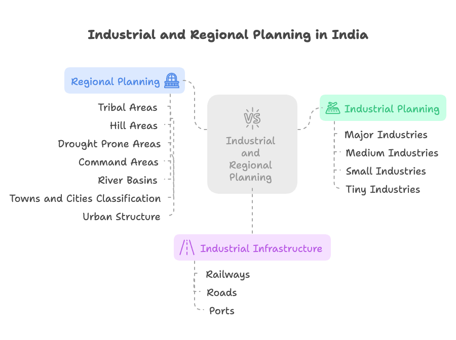
Regional Planning and Development – Tribal and Hill Areas, Drought Prone Areas, Command Areas and River Basins


I. Introduction

  • Regional Planning is the spatial organization of land use and socio-economic resources to promote balanced regional development, reduce disparities, and utilize natural resources optimally.
  • Focus Regions like tribal belts, hill areas, drought-prone zones, command areas, and river basins need area-specific planning due to their unique challenges and development potential.

II. Key Concepts

ConceptDefinition
Regional PlanningA methodical approach to improve infrastructure, economy, and ecology in specific geographic areas.
Tribal & Hill AreasRegions with indigenous populations or high-altitude terrains needing socio-cultural and environmental sensitivity.
Drought Prone AreasAreas facing recurring water stress, soil degradation, and crop failure.
Command AreasRegions served by irrigation canals from major dams and reservoirs.
River BasinsGeographic areas drained by a river and its tributaries; key for integrated water and land management.

III. Tribal and Hill Area Development

🔹 Characteristics

  • Low literacy, subsistence agriculture, forest-based livelihoods.
  • Sensitive ecological zones with high cultural diversity.

🔹 Planning Approaches

  • Integrated Tribal Development Projects (ITDPs).
  • Eco-sensitive tourism, sustainable agriculture, minor forest produce (MFP) value chains.
  • Emphasis on land rights (e.g., FRA 2006) and PESA (1996).

🔹 Karnataka Examples

  • BR Hills and MM Hills (Chamarajanagar): Eco-tourism and tribal welfare.
  • Kodagu and Chikkamagaluru: Coffee plantations, hill tourism.
  • Soliga & Jenu Kuruba Tribes: Targeted under Vanabandhu Kalyan Yojana.

IV. Drought Prone Area Development

🔹 Characteristics

  • Erratic rainfall, high evapotranspiration, groundwater depletion.
  • Rural distress, crop failures, migration.

🔹 Planning Tools

  • Watershed development.
  • Drought Proofing: Rainwater harvesting, afforestation.
  • Climate-resilient agriculture (millets, drip irrigation).

🔹 Government Interventions

  • Drought Prone Areas Programme (DPAP).
  • Integrated Watershed Management Programme (IWMP).
  • National Adaptation Fund for Climate Change (NAFCC).

🔹 Karnataka Specifics

  • Kalyana Karnataka: Kalaburagi, Yadgir, Bidar – prone to frequent droughts.
  • Tank rejuvenation and borewell recharge in Vijayapura and Bagalkot.
  • Promotion of ragi and jowar as drought-resilient crops.

V. Command Area Development (CAD)

🔹 Definition

  • Area served by an irrigation project (canals, dams).
  • Planning ensures optimal use of irrigation water, equitable distribution, and cropping pattern regulation.

🔹 Objectives

  • On-farm development (field channels, drainage).
  • Participatory Irrigation Management (PIM) via Water User Associations (WUAs).
  • Reduction in waterlogging and salinity.

🔹 Government Programs

  • Command Area Development and Water Management Programme (CADWMP).
  • PMKSY – Har Khet Ko Pani.

🔹 Karnataka Case Studies

  • Tungabhadra Command Area (Ballari, Raichur): Modern irrigation practices, drip systems.
  • Upper Krishna Project (UKP): One of India’s largest command area schemes.

VI. River Basin Planning and Development

🔹 Importance

  • Integrated development of agriculture, hydropower, fisheries, flood control, and water management.
  • Emphasis on inter-state coordination and ecological sustainability.

🔹 Approaches

  • Integrated River Basin Management (IRBM).
  • River Basin Authorities (e.g., Godavari, Krishna Basin Boards).
  • GIS-based hydrological mapping, aquifer mapping.

🔹 Challenges

  • Inter-state water disputes (e.g., Krishna, Cauvery).
  • Industrial pollution and urban encroachment.
  • Climate change-induced floods/droughts.

🔹 Karnataka Examples

  • Cauvery Basin: Mandya, Mysuru – intensive irrigation + hydroelectric projects.
  • Krishna Basin: Bagalkot, Vijayapura – UKP, Narayanpur Dam.
  • Sharavathi River Basin: Hydropower, ecotourism in Uttara Kannada.

VII. Government Schemes and Programs

Program/SchemeFocus Area
BRGF (now Rurban Mission)Backward region development
Special Central Assistance to Tribal Sub-PlanTribal welfare
IWMPWatershed development in drought-prone areas
PMKSYIrrigation and water-use efficiency
Namami Gange, Cauvery Management AuthorityRiver basin rejuvenation

VIII. Committees & Reports

  • Dantwala Committee (1973): Introduced DPAP for chronic drought areas.
  • Hanumantha Rao Committee (1984): Advocated watershed approach in drylands.
  • NITI Aayog Reports:
    • Promote district-level integrated planning.
    • Water Index Reports stress on command area efficiency.
  • Punchhi Commission (2010): On Centre–State coordination in inter-state river disputes.
  • K Kasturirangan Committee (Western Ghats): Identified eco-sensitive zones in hill regions.

IX. Current Affairs & Relevance

  • Ken-Betwa River Linking Project: First major river interlinking project with ecological concerns.
  • Desertification Atlas (ISRO 2023): Highlights drought-vulnerable zones.
  • GIS-based Planning: NITI Aayog’s push for geo-tagged development indicators.
  • Karnataka’s Pani Jala Samiti reforms under PMKSY: Promoting participatory irrigation.
  • Kodagu floods and landslides (2018–2022): Emphasis on regulated hill area planning.

X. Karnataka-Specific Regional Planning Initiatives

RegionPlanning Focus
Kalyana Karnataka (Hyderabad-Karnataka)Education (Kalyana Karnataka Region Development Board), irrigation (UKP)
Malnad & Coastal KarnatakaEco-tourism, agroforestry, slope stabilization
Dry zones (Tumakuru, Chitradurga)Watershed, horticulture, tank desilting
Hilly tribal areas (BR Hills, Western Ghats)Forest rights, biodiversity conservation, tribal livelihoods

XI. Examples & Case Studies

  • BR Hills (Soliga Tribe): Integration of tribal rights (FRA) with conservation.
  • Tungabhadra Command Area: PIM model via Water User Associations.
  • Kodagu Hill Planning: Post-disaster zoning to restrict construction.
  • Hulagur Watershed Project, Dharwad: Model for soil-water conservation in dry zones.
  • Krishna Basin Development: Narayanpur Left Bank Canal brings prosperity to Raichur district.

XII. Conclusion & Way Forward

  • Regional planning must be inclusive, ecologically sensitive, and resource-oriented.
  • Data-driven decentralized planning with community participation is essential.
  • Karnataka must integrate river basin development, tribal welfare, and drought-proofing under a unified state strategy.
  • Leveraging digital tools and convergence of schemes will promote resilient and equitable regional development.

Classification of Towns and Cities | Urban Structure


I. Introduction

  • Urban settlements play a key role in economic development, governance, and service delivery.
  • Urbanisation in India is rising rapidly (approx. 35% urban population, Census 2011).
  • Understanding the classification of towns and cities and their urban structure helps in effective urban planning and sustainable development.

II. Classification of Towns and Cities in India

Based on Census of India

As per the Census of India, towns and cities are classified into:

🔹 1. Statutory Towns

  • Declared as urban areas by state legislation.
  • Have municipal corporations, municipalities, or cantonment boards.
  • Example: Bengaluru (Bruhat Bengaluru Mahanagara Palike), Mysuru, Tumakuru.

🔹 2. Census Towns

  • Meet all 3 criteria:
    • Minimum population of 5,000.
    • At least 75% male workers in non-agricultural activities.
    • Population density of ≥400 persons/km².
  • Notified for census purposes but governed as rural areas.
  • Example: Byatarayanapura (before inclusion into BBMP).

Based on Population Size (Census Categories)

ClassPopulation RangeExample (Karnataka)
Class I>1,00,000Bengaluru, Mysuru
Class II50,000–99,999Shivamogga, Tumakuru
Class III20,000–49,999Chikkamagaluru, Udupi
Class IV10,000–19,999Hunsur
Class V5,000–9,999Pavagada
Class VI<5,000Small towns or semi-urban areas

Based on Function

Type of TownKey FeatureExample
AdministrativeHeadquarters of government officesDharwad, Ballari
CommercialTrade, banking, marketsBengaluru, Hubballi
IndustrialManufacturing hubsPeenya (Bengaluru), Ballari
ReligiousPilgrimage centresGokarna, Sringeri
EducationalPresence of major institutionsManipal, Dharwad
TouristDomestic and international tourismMysuru, Hampi

III. Urban Structure: Key Concepts and Theories

Urban structure refers to the spatial layout of cities, i.e., how residential, commercial, and industrial areas are arranged.

1. Concentric Zone Model (E.W. Burgess)

  • Urban growth spreads outward in concentric rings:
    1. Central Business District (CBD)
    2. Transitional zone (slums, factories)
    3. Working-class housing
    4. Middle-class suburbs
    5. Commuter zone

Example: Older areas of Bengaluru like Chickpet (CBD) surrounded by newer zones like Rajajinagar, Jayanagar, etc.


2. Sector Model (Homer Hoyt)

  • Urban areas grow in sectors or wedges, radiating out from the center.
  • Each sector accommodates specific land use: industrial, residential, etc.

Example: Bengaluru’s growth along major roads—Old Madras Road, Kanakapura Road.


3. Multiple Nuclei Model (Harris & Ullman)

  • Cities develop with multiple centers (nuclei) around which specific activities cluster.

Example: Bengaluru has IT hubs (Electronic City, Whitefield), business centers (MG Road), industrial zones (Peenya), etc.


4. Urban Fringe / Suburban Development

  • Areas at the edge of cities that show rapid development but lack infrastructure.
  • Urban sprawl often occurs in this zone.

Example: Yelahanka, Hoskote, and Devanahalli (Bengaluru fringe areas).


IV. Urban Planning Structures in India

🔹 Urban Local Bodies (ULBs)

  • Municipal Corporations (>1 million population)
  • Municipal Councils (0.1–1 million)
  • Nagar Panchayats (<0.1 million)

🔹 Planning Agencies

  • Town and Country Planning Department (TCPD): State-level urban planning.
  • Urban Development Authorities (UDAs): City-specific master planning (e.g., BDA – Bengaluru Development Authority).
  • AMRUT, Smart Cities Mission: National initiatives promoting structured urban growth.

V. Issues in Urban Structure

  • Haphazard Growth: Lack of zoning and enforcement.
  • Traffic Congestion: Poor transport planning.
  • Slum Proliferation: Inequitable development.
  • Urban-Rural Continuum: Blurring boundaries due to rapid peri-urban growth.
  • Ecological Strain: Encroachment of lakes, wetlands.

VI. Karnataka-Specific Urban Trends

  • Bengaluru: India’s fastest-growing city; suffers from unplanned expansion.
  • Mysuru: Well-zoned city with cultural heritage focus.
  • Hubballi–Dharwad: Twin-city model with coordinated urban governance.
  • Smart Cities: Belagavi, Davanagere, Shivamogga, Tumakuru included in Smart City Mission.
  • RURBAN Clusters: Transition zones in Chikkaballapur and Ramanagara districts.

VII. Government Schemes and Interventions

SchemeObjective
AMRUT (Atal Mission for Rejuvenation and Urban Transformation)Basic infrastructure in Class I cities
Smart Cities MissionSmart governance, ICT-enabled services
HRIDAYHeritage development in culturally significant cities
PMAY-UrbanAffordable housing for urban poor
National Urban Policy Framework (Draft 2018)10 transformative ideas for Indian urbanisation

VIII. Committees & Reports

  • Kasturirangan Committee (2022 Draft National Urban Policy): Emphasis on green urbanism.
  • High Powered Expert Committee (HPEC) for Urban Infrastructure (2011): Estimated ₹39 lakh crore urban infra need.
  • NITI Aayog Urban Mobility Reports: Push for metro, public transport, NMT.
  • Second Administrative Reforms Commission (ARC): Urban governance and decentralization.

IX. Current Affairs & Developments

  • Metro expansion in Karnataka: Namma Metro Phase 2A and 2B in progress.
  • New City Master Plans: Revision of CDPs for Bengaluru (2031), Mysuru, Mangaluru.
  • UN Habitat Report (2023): India among top urbanising nations; need for resilient cities.
  • Karnataka Urban Mobility Policy (2020): Integration of public and private transport.

X. Examples & Case Studies

  • Bengaluru’s ORR Growth: A practical example of Hoyt’s sector theory.
  • Peenya Industrial Area: Integrated into city’s concentric ring.
  • Mysuru’s CDP: Preservation of green belts while promoting tourism.
  • Udupi–Manipal Twin Urban Zone: Educational-commercial mixed nuclei.

XI. Conclusion & Way Forward

  • Urban classification and structure must guide zoning, infrastructure, and service delivery.
  • Karnataka’s urban areas need data-driven CDPs, transit-oriented development, and sustainable expansion.
  • Effective integration of urban–rural planning is critical for balanced development and avoiding urban chaos.

Leave a Reply

Your email address will not be published. Required fields are marked *